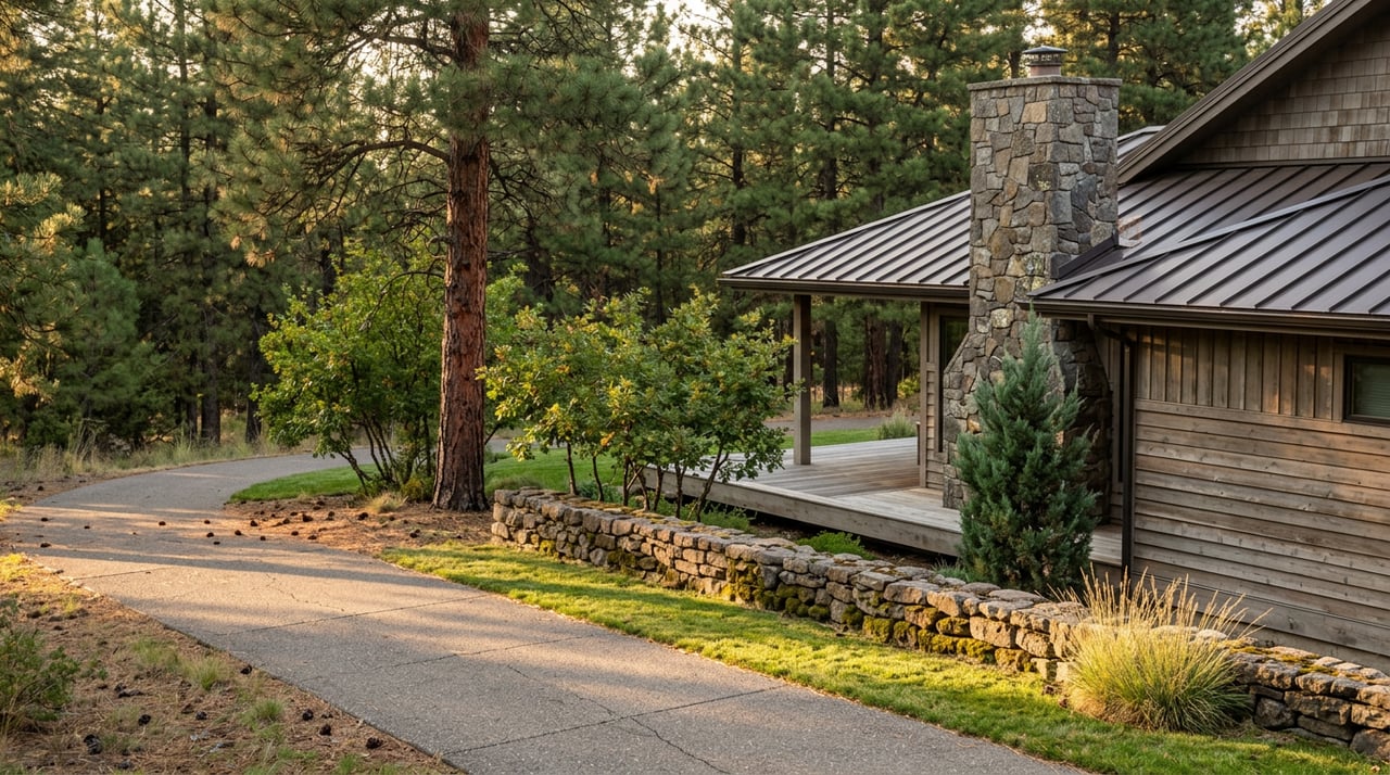
If you live in Ponderosa Trails, you probably have a version of the same evening routine: leash the dog, walk the paved loop past the picnic ramada, circle back before dark. That loop is Ponderosa Trails Park's own path, an easy 1.2-mile out-and-back that starts and ends near the community park off Wild West Trail. It is a fine description of what most people mean when they say "the trail."
It is also less than half the story.
The loop is a fragment of something longer
The path circling the park is one piece of a route the city calls the Ponderosa Trail, part of the Flagstaff Urban Trail System, or FUTS. According to TrailLink's trail database, the full route runs 2.5 miles, starting at the intersection of Beulah Boulevard and Lake Mary Road on the north end and finishing at Pulliam Airport, where JW Powell Boulevard meets S. Pulliam Drive on the south end. That's more than double the distance most residents cover before turning back toward their driveway.
The neighborhood greenbelt that everyone walks their dog through isn't a self-contained amenity. It's the middle third of a trail that starts at a major road and ends at an airport.
Three segments, one name
Trail logs from Trailforks break the route into three distinct pieces, and each one behaves differently underfoot:
- North segment follows the south side of Lake Mary Road, with a concrete surface that stays smooth and consistent.
- Middle segment cuts through the Ponderosa Trails greenbelt in a wide band of open space, with frequent, unmarked connections to neighborhood streets. This is the part almost everyone already knows.
- South segment runs along the west side of Pulliam Drive toward the airport boundary, and trail reports on TrailLink describe the asphalt here as rougher, with wide expansion cracks that make it noticeably bumpier for strollers and road bikes than the concrete stretch up north.
If you've only ever walked the middle third, the surface change alone is worth experiencing once. It's a small, physical reminder that the trail was built in pieces over time, not laid down as one continuous project.
Where the ends actually connect
The north end isn't just a dead stop at Lake Mary Road. According to TrailLink, that junction links to three separate named routes: the Sinclair Wash trail at Lake Mary Road, the High Country Trail at the intersection of Lake Mary Road and High Country Trail street, and the JWP Trail where Lake Mary Road meets JW Powell Boulevard. Someone starting from inside Ponderosa Trails can reach any of those three corridors on foot or by bike without touching a car.
The south end is the more unusual detail. Most FUTS corridors in Flagstaff connect neighborhoods to parks, schools, or downtown. This one connects a neighborhood directly to an airport. The trail ends at the working boundary of Pulliam Airport, at JW Powell Boulevard and S. Pulliam Drive. It's not a scenic overlook or a trailhead with a kiosk. It's simply where the pavement meets the airport's edge.
The loop around Ponderosa Trails Park covers 1.2 miles. The trail it belongs to covers 2.5.
No trailhead, no big sign
Here's the part that actually matters for how you use it day to day: there is no formal trailhead anywhere on the Ponderosa Trail. Trail logs describe it as a community trail with many entry points from the residences on either side, and parking is street parking only, wherever you happen to live along the route. You don't drive to this trail. You walk out your front door and you're already on it, or close to it.
The one clearly marked anchor along the whole route is Ponderosa Trails Park itself, an eight-acre, city-maintained park with a picnic ramada and grill tucked near Wild West Trail. It's the closest thing the corridor has to a landmark, which is probably why most residents treat the park loop as the trail rather than as one segment of it.
Mountain Charter School sits inside the same greenbelt system, close to the park. That's a genuinely practical thing to know if your evening walk overlaps with school dismissal. The trail and the pickup line aren't the same path, but they share the same stretch of neighborhood on weekday afternoons, and it's worth timing a walk around that if you'd rather not compete with car traffic near the school gate.
Part of a much bigger network
The Ponderosa Trail doesn't exist in isolation. It's one thread in the city's Flagstaff Urban Trail System, which the City of Flagstaff describes as roughly 56 to 59 miles of existing trail today, built toward a master plan of around 130 miles total. Trails in that system are generally eight to ten feet wide, and about half of the existing mileage is paved, with the other half a hard-packed aggregate surface. FUTS was designed from the start to link neighborhoods, schools, and natural areas across the city without requiring a car, and the Ponderosa Trail is a working example of that idea: a route that starts at a major arterial, threads through a residential greenbelt, and ends at a piece of transportation infrastructure most people only think about when they're catching a flight.
Worth walking past where you usually turn around
If your routine has always been the park loop, the interesting move is simple: keep going past the point where you'd normally circle back. Head north toward Lake Mary Road and you'll hit the junction with Sinclair Wash and the High Country Trail, both of which extend the walk well beyond the neighborhood. Head south past the park and you'll feel the surface change to rougher asphalt as the trail runs alongside Pulliam Drive toward the airport boundary, a stretch most residents have never had a reason to walk.
None of this changes what the trail is for day to day. It's still where you walk the dog, where the kids ride bikes after dinner, where a Saturday morning starts. But knowing that the loop is one third of a named, 2.5-mile route that connects three other trail corridors and ends at the airport changes how you might use it on the days you want to go farther than usual.
That's the kind of detail that doesn't show up on a real estate listing or a portal description. It shows up when you've actually walked the whole thing, not just the part with the picnic ramada.
If you're curious about other corners of Ponderosa Trails, or how this neighborhood compares to others around Flagstaff for daily life, recreation, or long-term plans, Karra Polder is always happy to talk through what makes each part of Northern Arizona work the way it does. Let's Connect.